
Project: Franklin / Cedar / Minnehaha
Location: Intersection of Franklin, Cedar, Minnehaha
This intersection has the second most bicycle crashes of any intersection in Minneapolis and it’s also one of the most dangerous intersections in Hennepin County, with crash rates more than two and a half times the “critical rate.”
Hennepin County and the City are working together to reconfigure this dangerous intersection to better serve all road users.
Word on the Street
Progress at Cedar/Franklin/Minnehaha!
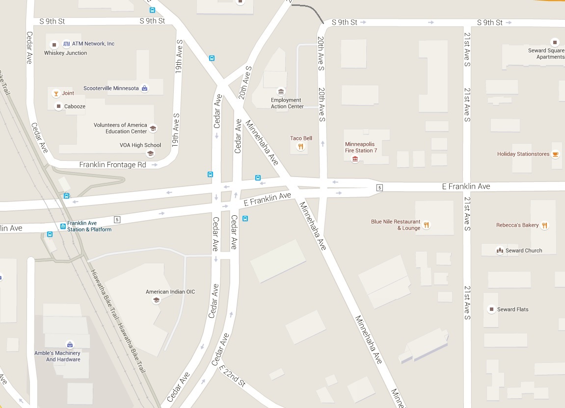
The intersection of Cedar/Franklin/Minnehaha is the second most dangerous intersection in Minneapolis, with the second most bicycle crashes. It is also one of the most dangerous intersections in Hennepin County, with vehicle crash rates more than two and a half times the “critical rate.”
Hennepin County, the City of Minneapolis, and other local groups worked together over the last few years to design a plan to improve this intersection (click image for bigger version).


